Cracks in the 2018 Kīlauea lava delta: what do they mean? — USGS Volcano Watch
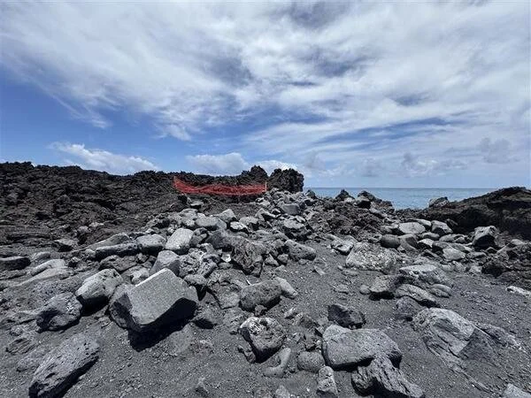
Kīlauea’s 2018 eruption transformed the lower Puna District of the Island of Hawaiʻi, including its coastline, where 875 acres of new land were added in a large lava delta. The area is still subject to sudden, dynamic changes, as evidenced by recent observations of new ground cracks in the lava delta near Pohoiki.
Aerial imagery time-series showing erosion along the northern edge of the 1960 lava delta spanning six decades after the eruption. The 1965 aerial photo on the left is from the U.S. Department of Agriculture, the 1990s satellite image in the center is from Spot Image, and the 2019 satellite image on the right is from Maxar.
The new cracks are alarming and have led people to wonder what they mean. To answer this question, there is fortunately a near-perfect analog for the 2018 lava delta located nearby to provide evidence of what its future may hold. This older lava delta was formed during the 1960 eruption of Kīlauea, which infamously destroyed the village of Kapoho. It was emplaced in a similar coastal environment to the 2018 lava delta, as both eruptions saw lava flows inundate a shallow marine platform before extending into deeper ocean waters.
As a result of reaching deeper ocean waters, both lava deltas are exposed to the full force of the Pacific Ocean, with no other islands or a nearshore coral reef to protect them. Due to regular volcanic activity, 90% of the coastline along Kīlauea is less than 1,000 years old and lacks a significant fringing reef. The only exceptions are areas that have been impacted by fault related subsidence that causes the coastal plain to sink below sea level—such as the Waiopae tidepools in Kapoho, which were covered by lava in 2018.
With nothing to impede it, wave action has had a substantial impact on the 1960 lava delta. Mapping using aerial imagery has shown that the coastline along the delta has eroded landward by 200 feet (60 meters) or more in many places. Most of this retreat occurred in the first few decades after the eruption, with the rate slowing thereafter, and in no place has the coastline receded past where it sat before the eruption.
Since no major collapse has ever been reported along the 1960 lava delta, the erosion is likely occurring more gradually. Most lava deltas consist of a solid surface atop loose submarine debris known as hyaloclastite, which forms when molten lava fragments upon hitting the water. This material is prone to subsidence due to compaction of the sediments over time and to erosion on the coastal edge because the loose debris is washed away underwater by longshore currents, destabilizing the solid lava above.
Sand and large, wave-rounded boulders frame the edge of the 2018 Kīlauea lava delta near Isaac Hale Beach Park. Wave action has eroded these boulders from the 2018 lava flow and deposited them on the beach. USGS photo by K. Mulliken.
The 2018 lava delta is likely in the early stages of the same processes. The beach at Pohoiki Bay is built from lava that fragmented when it entered the ocean in 2018 and was transported along the coast to the bay. Recently spotted cracks in the delta demonstrate the instability of solid lava along the coastal edge as the hyaloclastite sand and debris compacts and erodes away. Collapses of this lava are likely to be much smaller than collapses of active lava deltas, with at most a few tens of feet (several meters) slumping into the ocean.
Though these erosional collapses are relatively small, nobody will want to be standing on the coastal edge of the delta if a small section of lava slumps into the ocean, tossing them into the pounding surf. Small collapses could even produce small, highly localized rogue waves affecting areas like Pohoiki Bay and/or Kumukahi (the cape at the eastern tip of the island). As such, these growing cracks highlight the changing and hazardous nature of the coastline along the 2018 lava delta.
Though we can expect further erosional changes and minor hazards remain, lower Puna residents can be assured that any signs of instability along the 2018 coastline do not represent an indication of renewed volcanic activity in the area. The U.S. Geological Survey’s Hawaiian Volcano Observatory continues to closely monitor the lower East Rift Zone of Kīlauea, but geophysical data streams have shown no volcanic unrest here since 2018.
—
Volcano Watch is a weekly article and activity update written by U.S. Geological Survey Hawaiian Volcano Observatory scientists and affiliates.


